Garmin inReach Explorer Plus (GPS): Definitive Review (2024)
![Garmin inReach Explorer Plus (GPS): Definitive Review ([currentyear]) Garmin In Reach Explorer FI](https://topnotchoutdoor.com/wp-content/uploads/2020/06/Garmin-In-Reach-Explorer-FI.jpg)
Share this article:
TopNotch Outdoor is independent – we research, test, and rate the top products to help you make the right buying choice. We sometimes use affiliate links and may receive a small commission on your purchase. Learn more…
Welcome to the Ultimate Review of the Garmin inReach Explorer Plus 2024.
The TopNotch team presents a GPS that’s not just a great navigator but also an invaluable satellite communication tool.
In our comprehensive review we’ll cover:
- Product specs
- Speed and accuracy
- Performance comparison with the top products
- A whole lot more…
Forget those costly satellite phones…
Just imagine a GPS with an emergency communication safety net.
Sound good?
Then you’ll love this guide.
Let’s get busy.
![Garmin inReach Explorer Plus (GPS): Definitive Review ([currentyear]) q? encoding=UTF8&ASIN=B01MY03CZP&Format= SL250 &ID=AsinImage&MarketPlace=US&ServiceVersion=20070822&WS=1&tag=topnotch096 20&language=en US](http://ws-na.amazon-adsystem.com/widgets/q?_encoding=UTF8&ASIN=B01MY03CZP&Format=_SL250_&ID=AsinImage&MarketPlace=US&ServiceVersion=20070822&WS=1&tag=topnotch096-20&language=en_US)
- Manufacturer: Garmin Limited
- Display Size: 1.5 x 2.5 inches
- Display Type: Transflective color TFT touchscreen
- Weight: 7.5 oz
- Average Battery Life: 100 hours
Bottom Line : A reliable GPS and an effective messaging device for hikers and backpackers
Pros
- Offers two-way text communication
- GPS tracking feature
- Based on the reliable Iridium satellite network
- A smooth smartphone app
- A rechargeable lithium-ion battery
- A special SOS button
Cons
- It is a large and bulky device
- Extra monthly fee is needed
Our Verdict: Garmin inReach Explorer Plus
You’ve heard the advice a million times but let me repeat.
When heading outdoors, it’s best to be prepared for all kinds of emergencies.
And no matter what the emergency is, there’s one thing that’s essential.
A reliable means of communication.
With a 2-way satellite messenger service, the Garmin Inreach is a great tool when you’re out of cell tower range.
Just a few touches of the buttons and your location data (in the form of GPS coordinates) is shared with any of your contacts.
Most importantly, there’s a dedicated SOS tab for emergencies.
Obviously, it’s also an effective GPS with a simple interface that makes it perfect for newbie hikers.
Among the other perks, you get a superb battery life, good screen, and fast performance.
That said, ultralight hikers might find the Inreach a bit bulky.
And, the GPS functions are not as advanced as the TopNotch Top Picks in this category.
But considering the overall versatility and the reliable SOS feature, the manufacturer has done a great job combining multiple practical features into one GPS.
So how did it perform during our tests?
Hang on and you’ll find out…
Related: 10 Best Handheld GPS
Our Analysis Comparisons and Test Results
Allow me to take a few steps back.
The first two generations of inReach products were developed by DeLorme.
Back In 2016, Garmin acquired DeLorme and the third generation of the inReach device was launched.
Quite simply, a lot has been changed so it wouldn’t be fair to compare it with the Delorme Xplorer.
The best part is, you can use this as a standalone GPS or pair it up with your smartphone to send text messages.
In our GPS review trip in the Glacier National Park, we tried it both ways.
In fact, the inReach has an excellent weather forecasts feature that can make planning for daily treks so much easier.
But I’m jumping ahead.
Let’s check out this GPS come personal locator device – one step at a time.
Reception
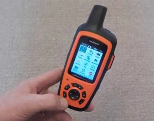
The truth is, reception quality was fine with the Garmin inReach Explorer Plus during our tests.
It works via the Iridium satellite system that ensures the fast transfer of two-way messages.
Note that the Iridium network is civilian and has global coverage.
Reception Rating
So it’s a great choice.
When it got cloudy, the connection took slightly longer to send text messages but never too long to be an issue.
Now, when we headed out to explore the lakes, we could easily send messages to one of our team members back in the town, a couple miles back.
Let’s talk about the emergency SOS button.
This connects you with the GEOS response center which is ready to act in an emergency situation 24/7.
Before you ask, the SOS button is designed specially to prevent accidental activation.
Even in the areas where we had a signal blackout, the inReach never failed to connect.
We tested it in built up areas, and it was equally good.
However, in forests, the reception was a bit slow compared to our other top choices like the Garmin GPSMAP 64st.
On the whole though, it was among the top performers in this category.
Ease of Use
Actually, we thought with multiple functions, the Garmin inReach Plus might be complicated to use.
We were pleasantly surprised.
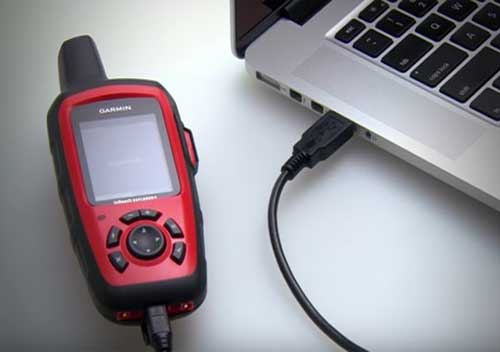
Firstly, you need a computer to set it up.
Then, visit the inReach.garmin.com for the activation process and choose a suitable satellite subscription plan.
Ease of Use Rating
There are a few to choose from.
We found the interface pretty simple – if maybe a bit dated.
We decided on a plan that provided up-to-date detailed weather forecasts for any location.
It gave us a clear indication of what conditions to expect on our hikes.
Needless to say, we loved this feature.
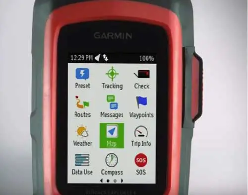
When it comes to satellite texting, you can send 3 pre-set messages or type in new ones.
The good thing is, there’s an audible confirmation when the text message is delivered.
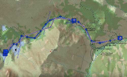
Also, you can share your route with selected contacts through the Mapshare platform.
There are also indicator lights to show low battery, unread messages, connection status, etc.
The Garmin inReach+ is loaded with DeLorme topo maps.
But they’re not as good as the Garmin’s full topo maps V5 when it comes to detail.
Note: You can use this by connecting it with your phone through the Earthmate® app or independently without the app.
Remember the days before we had touchscreen?
Clearly, typing messages with the rocker button is a pain.
Strictly speaking, for first-time users, this satellite messenger can feel a tad complicated.
In the end, it only scored average marks in this metric.
Display Quality
To be honest, the display quality here isn’t on par with our chart toppers like the Garmin gpsmap 64st.
Still, it does do its job.
The 2.31-inch diagonal display offers a resolution of 200 x 265 pixels, which we felt is good enough for overall use.
We found it pretty easy to read text messages even in bright sunlight at high altitudes.
Display Quality Rating
In addition, even steep viewing angles kept the readability steady.
Basically, the “trip info” screen provides all basic details and you can even customize it as you wish.
Keep in mind the screen doesn’t change orientation like a touchscreen.
So, if you do fancy a touchscreen, the Garmin Oregon 700 is worth checking out.
Warning:
We found the screen easy to scratch. So be careful where you store your inReach.
While using the 1:24000 scale topographic layer of North America and Canada, the screen resolution was just fine.
Sadly, the screen isn’t backlit.
To sum up, the Explorer+ has a simple but effective display.
Speed
In our comprehensive testing, the speed of the inReach was always within acceptable limits.
In fact, after a warm start, the satellite connection never took more than 2 to 3 minutes to get established.
It turns out, the SOS features are pretty effective and will keep sending your updated location to the emergency rescue services at regular intervals.
Speed Rating
Moreover, it has 2GB of internal memory to upload routes and waypoints as GPX files.
However, you can’t uninstall the basic maps preloaded in the device.
The best part?
All through our use, the device showed no signs of lag.
Turn on Bluetooth, connect to your smartphone via the Garmin EarthMate app – and sending messages is fast and easy.
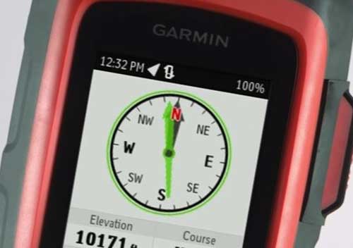
In addition, there’s a barometric altimeter and compass that both give fast and accurate data.
Also, syncing the GPS with a computer via a USB cable worked smoothly.
On the whole, the speedy performance of the Garmin inReach explorer Plus is a big plus.
Weight and Size
Let’s cut to the chase.
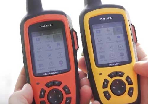
The inReach Garmin is the bulkiest among all the products we tested that trip.
And yes, it’s much heavier than your smartphone.
So, while it can do many things your smartphone can’t, it’s not the right choice if you need to pack light.
Weight and Size Rating
Even if you’re okay with the overall weight of 7.5 oz., the length of 6.5 inches does make it a plus size GPS.
That means users with small hands won’t find it easy to handle.
If you’re like us, you won’t want to keep it in your hand whilst navigating tough paths.
It’s too big to stuff into a jacket pocket.
The best option is to attach it to your backpack by the carabiner clip provided.
Before we go any further, here’s a quick comparison with the other members of the inReach family.
If you compare the Garmin inReach Explorer Plus vs Mini, you’ll find the inReach Mini is more compact. And its overall functionality is limited.
When it comes to the inReach SE Plus, it has almost the same dimensions as the Explorer Plus.
If a compact and capable GPS is what you need, the Garmin eTrex 20x is worth a look-see.
Versatility
When it comes to a versatile top-rated handheld GPS, the inReach Explorer Plus is right up there with the TopNotch award winners.
Actually, you can easily classify it as an emergency GPS that’s less expensive but more reliable than any satellite phone.
On top of that, you get features like digital maps, tracking, and a compass.
Versatility Rating
When it comes to the build quality, it’s rugged with a beefy feel.
Not to forget, it’s IPX7 rated for waterproofing.
The battery is a rechargeable lithium-ion pack and the Garmin inReach Explorer Plus manual states it’ll run for 100 hours at a 10-minute tracking mode.
In reality, it lasted more than three days when we minimized the tracking and optimized the screen brightness.
Or even better, set this to send just an occasional pre-set message and the battery will last for months.
Our Final Verdict: Garmin inReach Explorer Plus
Conclusion: Garmin inReach Explorer Plus
So, what’s going on with the Garmin Inreach Explorer Plus?
All in all, Garmin has effectively combined some of the best features to create a GPS come emergency rescue beacon.
Even if you move out of cell phone coverage, the top-class battery life will keep you in touch with civilization for days.
The back and forth text messaging worked smoothly while the saved routes and waypoints acted as guides across our route.
Now, don’t get carried away here.
Keep in mind it’s not the best navigation tool and has its limitations.
At the same time, it’ll always be a perfect backup navigation tool and a primary emergency locator.
As a seasoned hiker, if you’re looking for a dedicated GPS with high-quality maps, it’s best to stick to the Garmin GPSMAP 64st or the Garmin Foretrex 401.
On the other hand, if it’s a better display and a compact size you need, the Garmin eTrex 20x is a great option.
The last question – is the Garmin inReach Explorer Plus worth buying?
Definitely.
You just need to remember which applications it’s perfect for.
I’ve done the research, and written this review – now I hand the baton so you can make your best informed choice.
Thanks for reading!

![Ocean Kayak Comfort Plus Seat Back: Definitive Review ([currentyear]) Ocean Kayak Comfort Plus Seat Back: Definitive Review (2024)](https://topnotchoutdoor.com/wp-content/uploads/2021/05/Ocean-Kayak-Comfort-Plus-Seat-Back-FI-768x480.jpg)
![Geertop Tent: Definitive Review ([currentyear]) Geertop Tent: Definitive Review (2024)](https://topnotchoutdoor.com/wp-content/uploads/2020/07/Geertop-Feature-Imageopt-768x480.jpg)
![Newpowa Solar Panel (20W): Definitive Review ([currentyear]) Newpowa Solar Panel (20W): Definitive Review (2024)](https://topnotchoutdoor.com/wp-content/uploads/2020/06/New-Powa-Solar-Pannel-FI-768x480.jpg)
![Noble Queen Size Comfort Double High Raised Air Mattress - Definitive Review [currentyear]) Noble Queen Size Comfort Double High Raised Air Mattress – Definitive Review 2024)](https://topnotchoutdoor.com/wp-content/uploads/2020/07/Noble-Queenfeatureopt-768x480.jpg)
![Pulsar Generator (PG1202S): Definitive Review ([currentyear]) Pulsar Generator (PG1202S): Definitive Review (2024)](https://topnotchoutdoor.com/wp-content/uploads/2020/06/Pulsar-Generator-PG1202S-FI-768x480.jpg)
![Coleman Dual Fuel Lantern : Definitive Review ([currentyear]) Coleman Dual Fuel Lantern : Definitive Review (2024)](https://topnotchoutdoor.com/wp-content/uploads/2020/08/ColemanPremiumDuelFuelLanternfeatureopt-768x480.jpg)